BuckTrax

Map how they move.

Tag a buck across cameras and BuckTrax builds his movement routes — day by day or aggregated into corridors. At Buck tier, it predicts the terrain-aware path he took between sightings using every feature you've mapped on your property.

Get Early Access See Pricing
BuckTrax — "Tall 8" · Oct 14 · AM Route
1
East Bedding Cam — 5:38am
Departing bedding area · NW wind 7mph · Major solunar window open
Predicted → Saddle Pinch Point
Score: 94 · Natural funnel · Highest draw weight on route
2
Creek Crossing Cam — 5:54am
Crossed heading SW · 16 min from cam 1 · Falling pressure overnight
Predicted → Bench Trail
Score: 71 · User-confirmed travel trail · Connects saddle to creek bottom
3
Oak Flat Cam — 6:17am
Arrived from bench approach · 23 min travel time from cam 2
High Confidence — 2 hard funnels on route
All Tiers

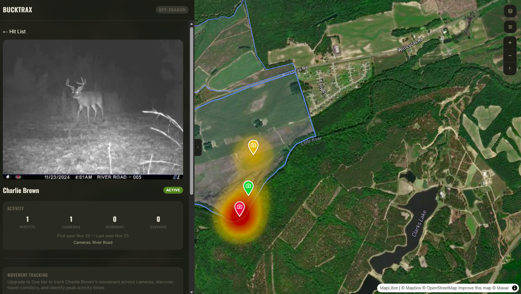
Build your hit list.

Every tier gets the hit list. Create profiles for individual bucks, tag their photos across cameras, and build a roster with activity timelines. Know who's on your property — and how often he's showing up in daylight — before you decide who to hunt.

  • Name, estimated age, antler score, and status tracking
  • Activity breakdown — morning, evening, and nocturnal sightings
  • Multi-camera visibility — which cameras a buck visits and when
  • Photo gallery with full browse across all tagged captures
Hit List — Active Bucks This Season
Tall 8 · Est. 4.5 yrs
Target Buck
Last seen: Oct 14 · 6:17am · Oak Flat Cam
23
Sightings
61%
Daylight
3
Cameras
AM
Peak Sit
Drop Tine · Est. 5.5 yrs
Harvested
Harvested Nov 2 · 7:04am · Oak Flat Stand
41
Sightings
74%
Daylight
4
Cameras
AM
Peak Sit
Doe + Buck

See the routes. Find the corridors.

At Doe tier and above, BuckTrax maps every multi-camera sighting as a movement line on your satellite map. Switch between aggregate corridor view to see overall patterns, or drill into a single day to trace an exact route with numbered waypoints, timestamps, and weather conditions at each capture.

  • Aggregate corridors with AM vs PM breakdown and frequency counts
  • Single-day routes with numbered sequence and weather at each sighting
  • Filter all movement data by temp, wind, barometer, moon, or sky conditions
  • Date navigation with route-day badges for multi-camera days
Tall 8 — Aggregate Corridors · Oct–Nov
AM Routes · 14 PM Routes · 6
East Bedding → Creek Crossing
14 of 20 AM routes · Avg travel: 18 min · Primary AM corridor
Creek Crossing → Oak Flat
11 of 20 routes · Passes saddle 100% of the time
Food Plot → North Fence (PM only)
6 of 6 PM routes · SW wind only · Enters from south timber edge

Saddle pinch point appears on 18 of 20 total routes. Unoccupied stand 60 yards south of saddle.

Buck Tier

Predict the path between sightings.

Movement routes show where a buck was seen. Predicted paths show how he got there. BuckTrax scores every terrain feature you've mapped — saddles, pinch points, trails, water, bedding, food plots — and builds a terrain-aware corridor with scored waypoints and a confidence rating.

  • Terrain features scored by type — saddles and pinch points rank highest
  • Time-of-day modifiers — bedding draws harder in the morning, food plots at evening
  • High / Medium / Low confidence scoring based on feature density and funnels
  • Plain-English reasoning explains exactly why each waypoint was selected
Predicted Path — Tall 8 · Oct 14 · 5:38–6:17am
1
East Bedding Cam — confirmed
Departure point · 5:38am
Saddle — terrain waypoint
Score: 94 · Natural funnel, highest draw weight · 0.18mi from cam 1
Bench Trail — terrain waypoint
Score: 71 · User-confirmed travel trail · Connects saddle to creek bottom
2
Creek Crossing Cam — confirmed
5:54am · Path validated — buck crossed exactly as predicted
High Confidence · 2 hard funnels on route

Stand suggestion: 60 yards NW of saddle waypoint — clean approach, NW wind favorable, unoccupied

How predicted paths work.

Every feature on your property gets scored. The best ones become waypoints.

Feature Draw Weights

Saddles, pinch points, and trails score highest. Food plots and bedding are time-dependent. Roads and fences are barriers.

Time-of-Day Scoring

Bedding areas pull harder in the morning. Food plots pull harder in the evening. Midday scoring drops for both.

Proximity to Travel Line

Features closer to the direct line between cameras score higher. Corridor width adjusts based on transit time.

Confidence Scoring

Combines feature quality, density, and funnel presence. High confidence means hard terrain funnels line up on the route.

Season Phase Weights

Five phases — early, pre-rut, rut, post-rut, late — each adjust feature draw and expected range radius.

You Set the Weights

Adjust how much each terrain feature type influences predictions. Your 20 years on that lease matters more than any algorithm.

Hit list is included on all plans. Movement routes unlock at Doe ($99/yr). Predicted paths require Buck ($129/yr).

Compare Plans

Tag a buck. Track his pattern.
Predict where he walks.

Get Early Access