TopoLens — Terrain Intelligence

Know your ground.

TopoLens maps your property's terrain features using USGS topographic data and lets you mark every stand, trail, food plot, and water source. The more you scout, the smarter BuckCast and BuckTrax become.
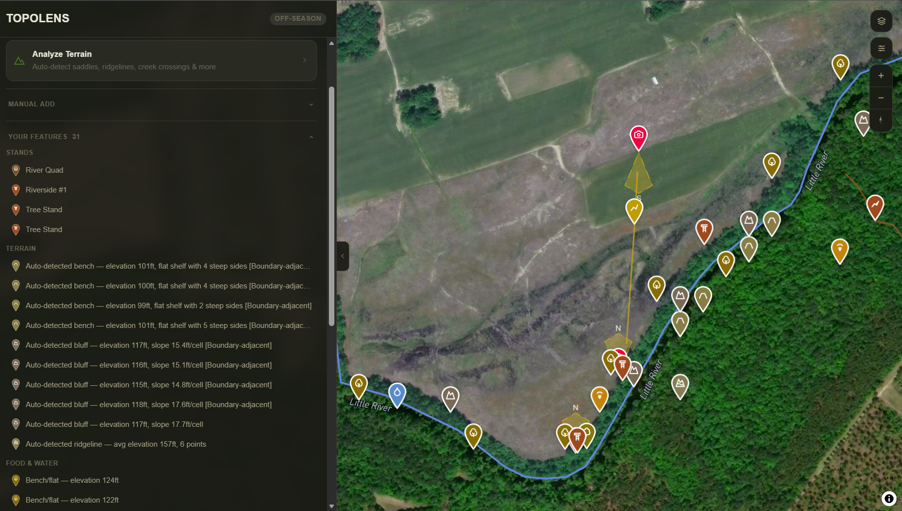
TopoLens showing terrain analysis with auto-detected features alongside satellite map
TopoLens — Terrain Analysis · 180 Acres
1,225 points sampled 88ft total relief 18 features found
Saddle — elevation 1,250ft87% confidence
Natural pinch point between two ridges · 0.12mi from Creek Crossing Cam
AddDismiss
Ridgeline — elevation 1,340ft94% confidence
Runs NE to SW · Connects bedding area to oak flat · 320 yards
AddDismiss
Creek Crossing — elevation 1,180ft91% confidence
Low bank crossing point · 0.08mi from existing camera
AddDismiss
✦ 18 features detected. You review every suggestion — confirm what matches your ground, dismiss what doesn't.
USGS Terrain Analysis

Your property's terrain, mapped in one click.

TopoLens samples elevation data across your entire property boundary using USGS topographic data and automatically detects terrain features that funnel deer movement — saddles, ridgelines, benches, creek crossings, and pinch points.

  • Auto-detect saddles, ridgelines, benches, and creek crossings from USGS data
  • Confidence score on every detection — know what the data is certain about
  • 100-meter buffer catches features just outside your fence line
  • Every result is a suggestion — you confirm or dismiss based on what you know
Terrain Results — Review Queue
Saddle — 1,250ft87%
Natural funnel between two ridges · Highest draw weight on property
Bench — 1,290ft100%
Flat shelf on south-facing slope · Likely bedding area
Creek Crossing — 1,180ft91%
Low bank crossing · Confirmed by NHD water data
Ridgeline — 1,340ft94%
Runs NE–SW · 320 yards · Connects bedding to food source
Scales with your property — 20 acres or 300 acres, TopoLens samples the entire boundary.
Manual Mapping

Mark what only you know about your ground.

USGS data finds the terrain. You fill in the rest. Place stands and blinds, trace trails and fence lines, mark food plots and water sources. Every feature you add makes BuckTrax corridors and BuckCast predictions more accurate.

  • Place stands, blinds, and bedding areas with one tap
  • Draw trails, roads, fences, drainages, ridgelines, and timber edges
  • Mark food plots, water sources, mineral licks, and scrape lines
  • Auto-detect creek crossings on drawn water and drainage lines
TopoLens — Feature Tools
Place
Stand
Blind
Bedding
Draw
Trail
Road
Drainage
Mark
Food Plot
Water
Mineral
Feature Management

Every feature powers the prediction engine.

Your scouted features aren't just pins on a map. Every stand, trail, food plot, and terrain feature feeds directly into BuckTrax corridor predictions and BuckCast stand rankings. The more features you map, the more accurate your predictions become.

  • Features grouped by type with color-coded map markers
  • Toggle scent cones on stands — green zone and red zone on the map
  • Features feed into BuckTrax corridors and BuckCast stand rankings
  • Add notes, edit locations, and manage your property intelligence over time
Your Features — North 80 Property
Stands 4
Water & Drainage 3
Food Plots 2
Terrain (Saddles, Ridgelines) 6
Trails & Roads 5
Fences & Barriers 2
22 features mapped · Features improve BuckCast accuracy by weighting stand proximity to terrain funnels.

TopoLens terrain analysis and feature mapping are included on all plans — Fawn, Doe, Buck, and Outfitter.

Compare Plans

Know your ground before you
set foot on it.

14 days free. No credit card required.