Trail Camera Intelligence
You've been watching him all summer. Now pattern him.
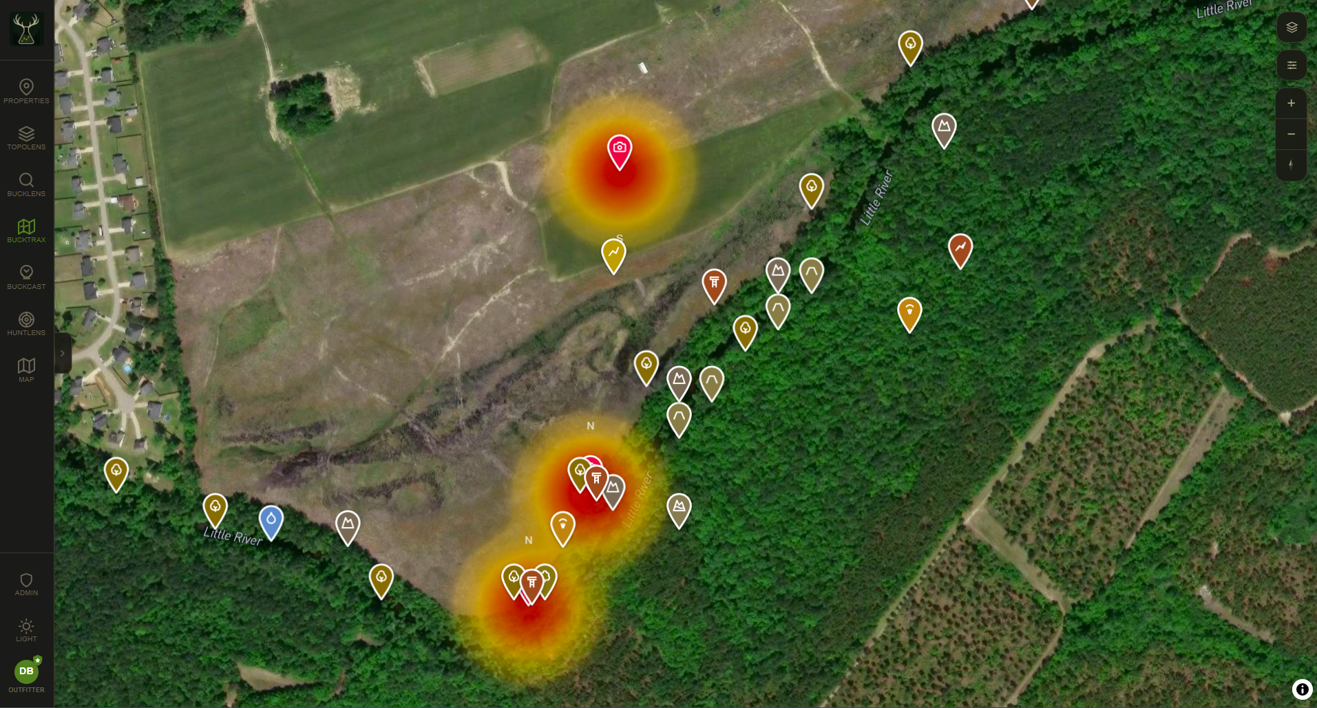
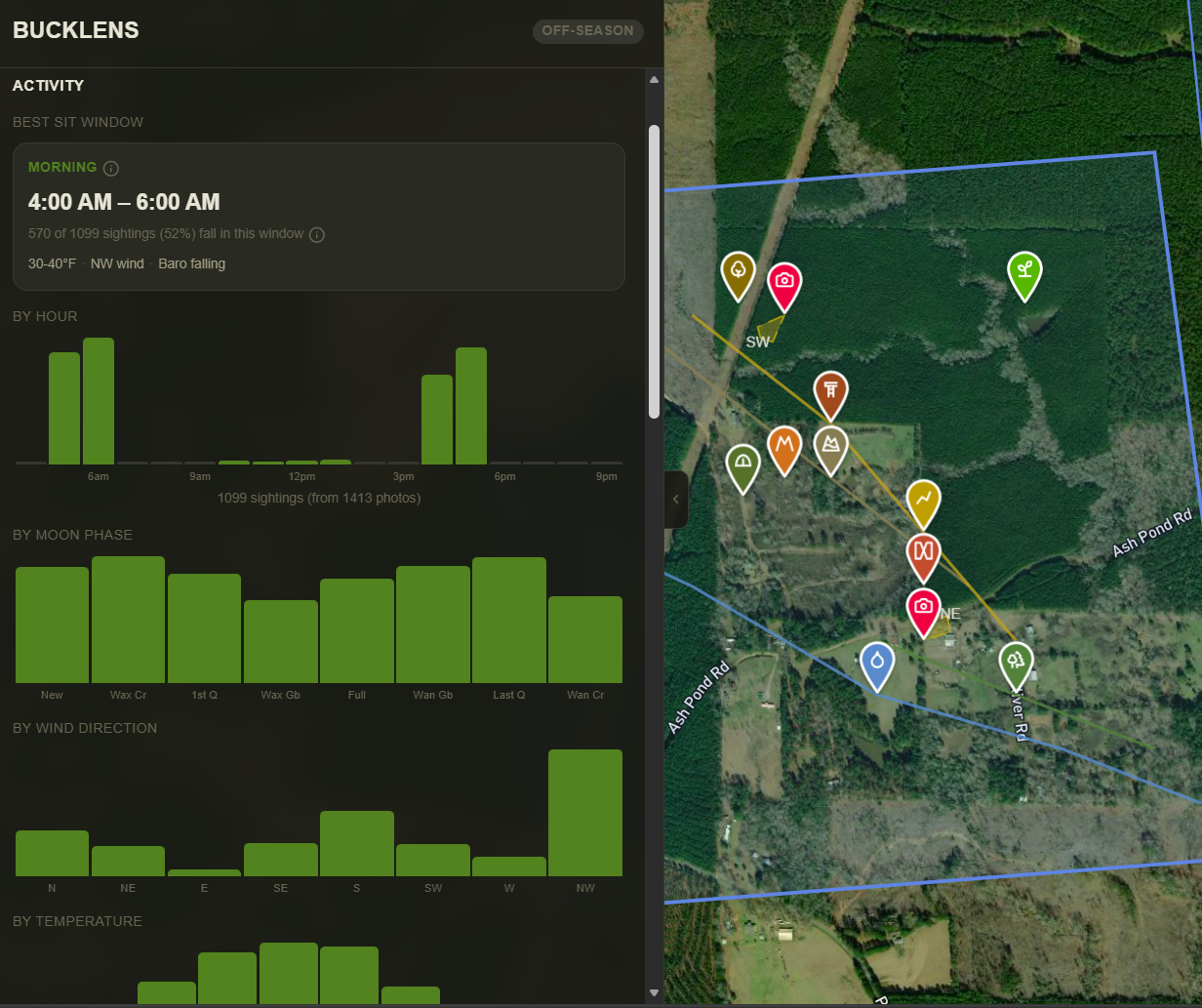
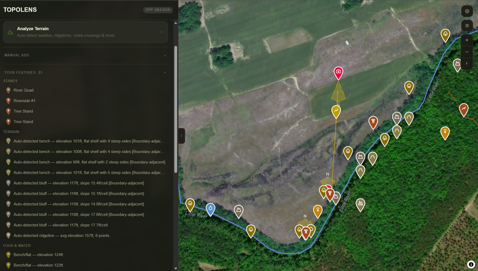
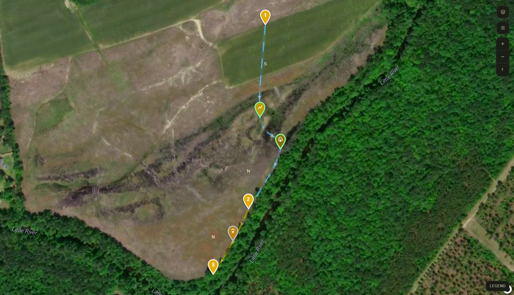
Your trail cameras are already collecting everything you need to decode this buck. Weather on every sighting. Timestamps across cameras. Movement confirmed by terrain. BuckScience™ reads your data and builds his playbook.
Not a generic algorithm. Your ground. Your cameras. His patterns.
14 days free · No credit card · No charge until you subscribe